
DC topographic map
Interactive map
Click on the map to display elevation.
About this map
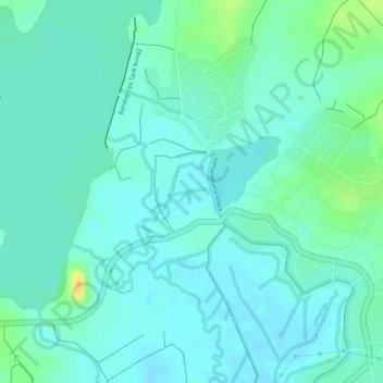
Name: DC topographic map, elevation, terrain.
Average elevation: 24 m
Minimum elevation: 15 m
Maximum elevation: 49 m
Other topographic maps
Click on a map to view its topography, its elevation and its terrain.
Hambantota
Sri Lanka > Southern Province > Hambantota
Hambantota, Hambantota District, Southern Province, Sri Lanka
Average elevation: 12 m
DC
Sri Lanka > Southern Province > Hambantota
DC, Hambantota, Hambantota District, Southern Province, 82004, Sri Lanka
Average elevation: 17 m