
Jakomini topographic map
Interactive map
Click on the map to display elevation.
About this map
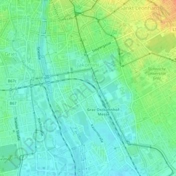
Name: Jakomini topographic map, elevation, terrain.
Location: Jakomini, Graz, Styria, Austria (47.04478 15.43424 47.06719 15.46899)
Average elevation: 353 m
Minimum elevation: 340 m
Maximum elevation: 379 m
Other topographic maps
Click on a map to view its topography, its elevation and its terrain.