
Straubing topographic map
Interactive map
Click on the map to display elevation.
About this map
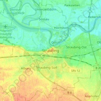
Name: Straubing topographic map, elevation, terrain.
Location: Straubing, Lower Bavaria, Bavaria, 94315, Germany (48.84198 12.52972 48.92198 12.60972)
Average elevation: 327 m
Minimum elevation: 313 m
Maximum elevation: 347 m