
Reghin topographic map
Interactive map
Click on the map to display elevation.
About this map
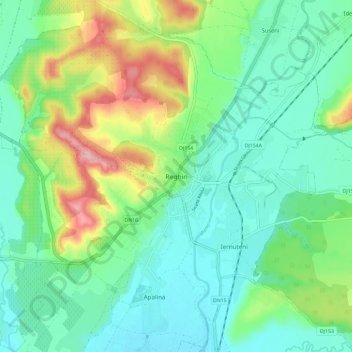
Name: Reghin topographic map, elevation, terrain.
Location: Reghin, Mureș, 545300, Romania (46.73969 24.66002 46.81969 24.74002)
Average elevation: 398 m
Minimum elevation: 352 m
Maximum elevation: 511 m