
Nurri topographic map
Interactive map
Click on the map to display elevation.
About this map
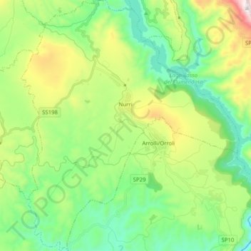
Name: Nurri topographic map, elevation, terrain.
Location: Nurri, Sud Sardegna, Sardaigne, 08035, Italie (39.64208 9.16509 39.76176 9.30050)
Average elevation: 479 m
Minimum elevation: 154 m
Maximum elevation: 1,204 m