
Krasnokamensk topographic map
Interactive map
Click on the map to display elevation.
About this map
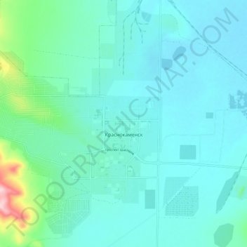
Name: Krasnokamensk topographic map, elevation, terrain.
Average elevation: 653 m
Minimum elevation: 622 m
Maximum elevation: 834 m
Other topographic maps
Click on a map to view its topography, its elevation and its terrain.
Krasnokamensk
Russia > Zabaykalsky Krai > Krasnokamensky District > Krasnokamensk
Krasnokamensk, городское поселение Краснокаменск, Krasnokamensky District, Zabaykalsky Krai, Far Eastern Federal District, 6765, Russia
Average elevation: 657 m