
Podkum topographic map
Interactive map
Click on the map to display elevation.
About this map
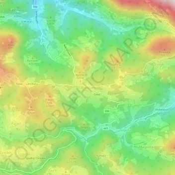
Name: Podkum topographic map, elevation, terrain.
Location: Podkum, Zagorje ob Savi, 1414, Slovenia (46.04968 15.01440 46.08968 15.05440)
Average elevation: 670 m
Minimum elevation: 422 m
Maximum elevation: 1,040 m
Other topographic maps
Click on a map to view its topography, its elevation and its terrain.
Bebar
Slovenia > Zagorje ob Savi > Vrh
Bebar, Vrh, Zagorje ob Savi, 1410, Slovenia
Average elevation: 430 m