
Slavyanka topographic map
Interactive map
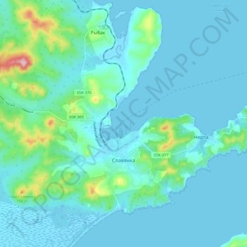
Click on the map to display elevation.
About this map
Name: Slavyanka topographic map, elevation, terrain.
Average elevation: 30 m
Minimum elevation: -4 m
Maximum elevation: 227 m
Other topographic maps
Click on a map to view its topography, its elevation and its terrain.
Slavyanka
Russia > Primorsky Krai > Slavyanka
Slavyanka, Славянское городское поселение, Khasansky District, Primorsky Krai, Far Eastern Federal District, Russia
Average elevation: 30 m