
Mobile River topographic map
Interactive map
Click on the map to display elevation.
About this map
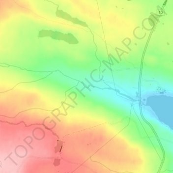
Name: Mobile River topographic map, elevation, terrain.
Location: Mobile River, St. John's, Neufundland und Labrador, Kanada (47.25082 -52.85449 47.25090 -52.85416)
Average elevation: 74 m
Minimum elevation: -1 m
Maximum elevation: 143 m
Other topographic maps
Click on a map to view its topography, its elevation and its terrain.
Stravanger Drive Park
Kanada > Neufundland und Labrador > St. John's
Stravanger Drive Park, Stavanger Drive, St. John's, Neufundland, Neufundland und Labrador, Kanada
Average elevation: 92 m
St. John's
Kanada > Neufundland und Labrador > St. John's
St. John's, Neufundland, Neufundland und Labrador, Kanada
Average elevation: 76 m