
Plage de Nantouar topographic map
Interactive map
Click on the map to display elevation.
About this map
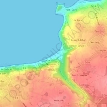
Name: Plage de Nantouar topographic map, elevation, terrain.
Average elevation: 39 m
Minimum elevation: 0 m
Maximum elevation: 84 m
Other topographic maps
Click on a map to view its topography, its elevation and its terrain.
Plage de Port l'Épine
Plage de Port l'Épine, Hent ar Palud, Pors Garo, Trélévern, Lannion, Côtes-d'Armor, Bretagne, France métropolitaine, 22660, France
Average elevation: 16 m