
Yanahuara topographic map
Interactive map
Click on the map to display elevation.
About this map
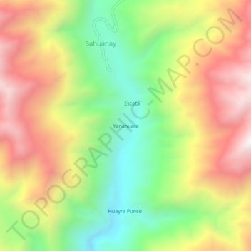
Name: Yanahuara topographic map, elevation, terrain.
Location: Yanahuara, General Sánchez Cerro, Moquegua, Peru (-16.80919 -71.19775 -16.76919 -71.15775)
Average elevation: 2,035 m
Minimum elevation: 1,505 m
Maximum elevation: 2,606 m