
Potosí topographic map
Interactive map
Click on the map to display elevation.
About this map
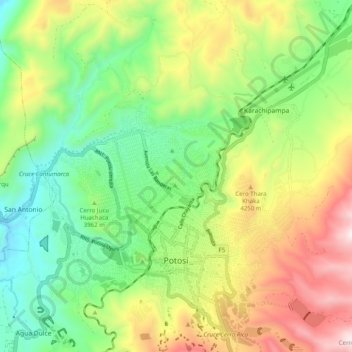
Name: Potosí topographic map, elevation, terrain.
Location: Potosí, Provincia Tomás Frías, Potosí, Bolivia (-19.61045 -65.79983 -19.52319 -65.70060)
Average elevation: 4,006 m
Minimum elevation: 3,564 m
Maximum elevation: 4,700 m