
KG Kagran topographic map
Interactive map
Click on the map to display elevation.
About this map
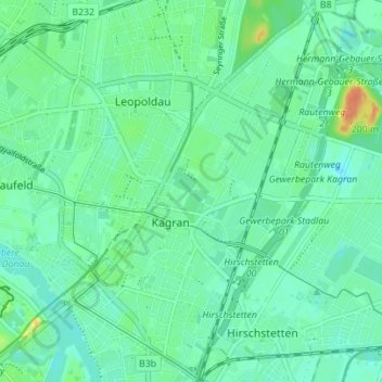
Name: KG Kagran topographic map, elevation, terrain.
Location: KG Kagran, Donaustadt, Neukagran, Vienna, 1220, Austria (48.22979 16.41476 48.27531 16.48426)
Average elevation: 162 m
Minimum elevation: 152 m
Maximum elevation: 189 m
Other topographic maps
Click on a map to view its topography, its elevation and its terrain.
KG Leopoldstadt
KG Leopoldstadt, Leopoldstadt, Neukagran, Vienna, 1020, Austria
Average elevation: 171 m