
Ilsington topographic map
Interactive map
Click on the map to display elevation.
About this map
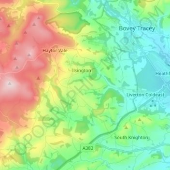
Name: Ilsington topographic map, elevation, terrain.
Location: Ilsington, Teignbridge, Devon, England, United Kingdom (50.53459 -3.78049 50.59609 -3.65400)
Average elevation: 171 m
Minimum elevation: 16 m
Maximum elevation: 472 m