
Pathhead topographic map
Interactive map
Click on the map to display elevation.
About this map
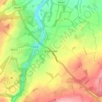
Name: Pathhead topographic map, elevation, terrain.
Location: Pathhead, Midlothian, Scotland, EH37 5PY, United Kingdom (55.84717 -2.98749 55.88717 -2.94749)
Average elevation: 163 m
Minimum elevation: 96 m
Maximum elevation: 236 m