
Venna Lake topographic map
Interactive map
Click on the map to display elevation.
About this map
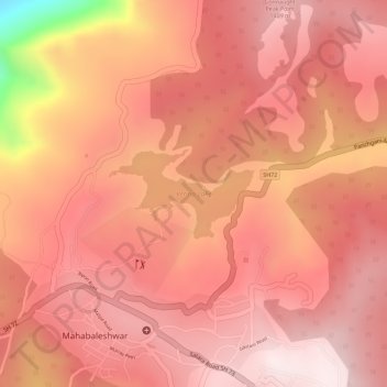
Name: Venna Lake topographic map, elevation, terrain.
Average elevation: 1,320 m
Minimum elevation: 914 m
Maximum elevation: 1,436 m
Other topographic maps
Click on a map to view its topography, its elevation and its terrain.
Mahabaleshwar
India > Maharashtra > Mahabaleshwar
Mahabaleshwar, Satara, Maharashtra, 412806, India
Average elevation: 1,112 m