
Portesham topographic map
Interactive map
Click on the map to display elevation.
About this map
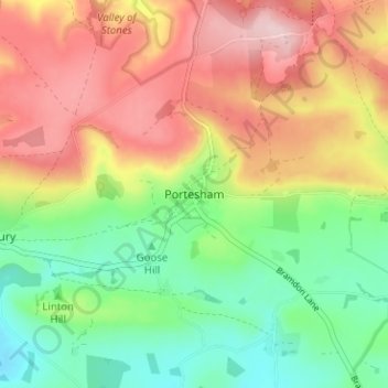
Name: Portesham topographic map, elevation, terrain.
Average elevation: 110 m
Minimum elevation: -1 m
Maximum elevation: 238 m
Other topographic maps
Click on a map to view its topography, its elevation and its terrain.
Valley of Stones
United Kingdom > England > Portesham
Valley of Stones, Bishop's Road, Littlebredy, Portesham, Dorset, South West England, England, DT2 9HX, United Kingdom
Average elevation: 167 m