
West Kill topographic map
Interactive map
Click on the map to display elevation.
About this map
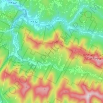
Name: West Kill topographic map, elevation, terrain.
Average elevation: 664 m
Minimum elevation: 384 m
Maximum elevation: 1,179 m
Other topographic maps
Click on a map to view its topography, its elevation and its terrain.
Town of Lexington
United States > New York > Greene County > Town of Lexington
Town of Lexington, Greene County, New York, United States
Average elevation: 657 m