
Rüthi topographic map
Interactive map
Click on the map to display elevation.
About this map
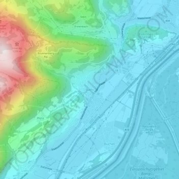
Name: Rüthi topographic map, elevation, terrain.
Location: Rüthi, Wahlkreis Rheintal, Sankt Gallen, 9464, Switzerland (47.27559 9.51719 47.31559 9.55719)
Average elevation: 595 m
Minimum elevation: 410 m
Maximum elevation: 1,377 m