
Gazipur topographic map
Interactive map
Click on the map to display elevation.
About this map
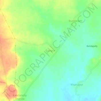
Name: Gazipur topographic map, elevation, terrain.
Location: Gazipur, Vikarabad, Telangana, India (17.29096 77.61568 17.33096 77.65568)
Average elevation: 483 m
Minimum elevation: 464 m
Maximum elevation: 508 m