
Christ Church topographic map
Interactive map
Click on the map to display elevation.
About this map
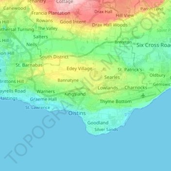
Name: Christ Church topographic map, elevation, terrain.
Location: Christ Church, Barbados (13.04471 -59.60673 13.12044 -59.47233)
Average elevation: 46 m
Minimum elevation: 0 m
Maximum elevation: 212 m
Other topographic maps
Click on a map to view its topography, its elevation and its terrain.