
Kavajë topographic map
Interactive map
Click on the map to display elevation.
About this map
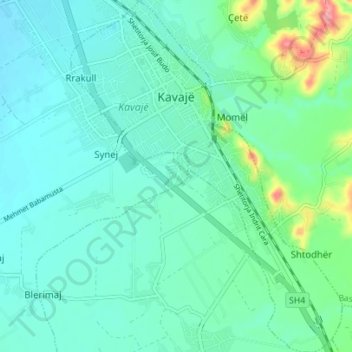
Name: Kavajë topographic map, elevation, terrain.
Location: Kavajë, Kavaje, Tirana County, Central Albania, 2501, Albania (41.14516 19.53908 41.19755 19.59290)
Average elevation: 30 m
Minimum elevation: 5 m
Maximum elevation: 129 m
The highest elevation point is the peak of Bezmajet which reaches a height of 391.97 m (1,286 ft). The lowest depression point is found near the shores of Karpen at −10 m (−33 ft) below sea level.