
Lohmar topographic map
Interactive map
Click on the map to display elevation.
About this map
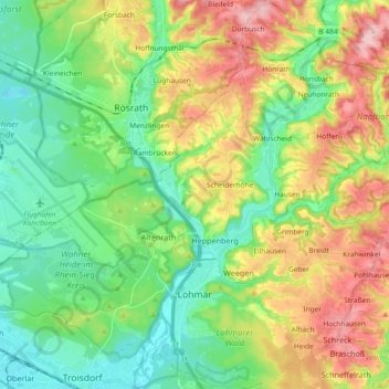
Name: Lohmar topographic map, elevation, terrain.
Location: Lohmar, Rhein-Sieg-Kreis, North Rhine-Westphalia, 53797, Germany (50.81183 7.19081 50.92853 7.30656)
Average elevation: 122 m
Minimum elevation: 52 m
Maximum elevation: 243 m