
Senftenberg topographic map
Interactive map
Click on the map to display elevation.
About this map
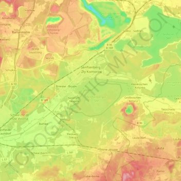
Name: Senftenberg topographic map, elevation, terrain.
Average elevation: 110 m
Minimum elevation: 50 m
Maximum elevation: 167 m
Other topographic maps
Click on a map to view its topography, its elevation and its terrain.
Schipkau
Germany > Brandenburg > Oberspreewald-Lausitz - Górne Błota-Łužyca
Schipkau, Oberspreewald-Lausitz - Górne Błota-Łužyca, Brandenburg, Germany
Average elevation: 123 m