
Wustrow topographic map
Interactive map
Click on the map to display elevation.
About this map
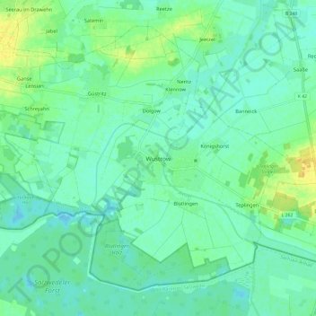
Name: Wustrow topographic map, elevation, terrain.
Average elevation: 20 m
Minimum elevation: 12 m
Maximum elevation: 36 m
Other topographic maps
Click on a map to view its topography, its elevation and its terrain.
Blütlingen
Deutschland > Niedersachsen > Lüchow-Dannenberg > Wustrow > Blütlingen
Blütlingen, Wustrow, Samtgemeinde Lüchow (Wendland), Lüchow-Dannenberg, Niedersachsen, 29462, Deutschland
Average elevation: 19 m