
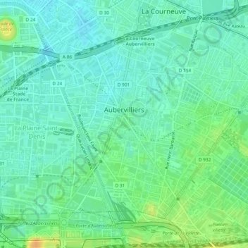
Aubervilliers topographic map
Interactive map
Click on the map to display elevation.
About this map
Name: Aubervilliers topographic map, elevation, terrain.
Average elevation: 43 m
Minimum elevation: 33 m
Maximum elevation: 64 m
Other topographic maps
Click on a map to view its topography, its elevation and its terrain.
Square Émilienne Moreau Evrard
France > Île-de-France > Seine-Saint-Denis > Aubervilliers
Average elevation: 41 m
Château de Villemomble
France > Île-de-France > Seine-Saint-Denis > Villemomble
Average elevation: 77 m
Épinay-sur-Seine
France > Île-de-France > Seine-Saint-Denis > Épinay-sur-Seine > Épinay-sur-Seine
Average elevation: 46 m
Clos d'Heurtebise
France > Île-de-France > Seine-Saint-Denis > Gournay-sur-Marne > Clos d'Heurtebise
Average elevation: 56 m
Place du 11 novembre 1918
France > Île-de-France > Seine-Saint-Denis > Clichy-sous-Bois
Average elevation: 98 m
Le Blanc-Mesnil
France > Île-de-France > Seine-Saint-Denis > Le Blanc-Mesnil > Le Blanc-Mesnil
Average elevation: 53 m
Mail François Mitterrand (parc PVC)
France > Île-de-France > Seine-Saint-Denis > Bobigny
Average elevation: 52 m
Noisy-le-Grand
France > Île-de-France > Seine-Saint-Denis > Noisy-le-Grand > Noisy-le-Grand
La commune s'étend sur 12,95 k㎡ dont 285 hectares du Bois Saint-Martin, situé à l'extrémité sud de la commune. L'espace urbain de Noisy-le-Grand s'étend sur environ 4 km d'est en ouest et environ 5 km du nord au sud. Son altitude varie de 36 mètres à 113 mètres.
Average elevation: 70 m
Livry-Gargan
France > Île-de-France > Seine-Saint-Denis > Livry-Gargan > Livry-Gargan
Average elevation: 71 m
Tremblay-en-France
France > Île-de-France > Seine-Saint-Denis > Tremblay-en-France > Tremblay-en-France
Average elevation: 82 m