
Manacor topographic map
Interactive map
Click on the map to display elevation.
About this map
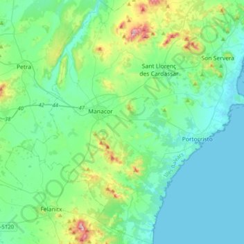
Name: Manacor topographic map, elevation, terrain.
Location: Manacor, Llevant, Balearic Islands, Spain (39.43886 3.12263 39.67890 3.37589)
Average elevation: 89 m
Minimum elevation: 0 m
Maximum elevation: 476 m