
Boechout topographic map
Interactive map
Click on the map to display elevation.
About this map
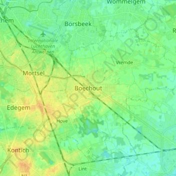
Name: Boechout topographic map, elevation, terrain.
Location: Boechout, Antwerp, Flanders, 2530, Belgium (51.12356 4.45639 51.20356 4.53639)
Average elevation: 12 m
Minimum elevation: 3 m
Maximum elevation: 25 m