
Rock County topographic map
Interactive map
Click on the map to display elevation.
About this map
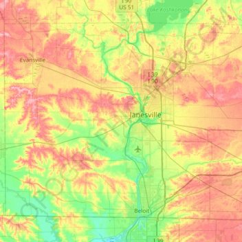
Name: Rock County topographic map, elevation, terrain.
Location: Rock County, Wisconsin, United States (42.49195 -89.36918 42.84765 -88.77605)
Average elevation: 266 m
Minimum elevation: 219 m
Maximum elevation: 327 m
Other topographic maps
Click on a map to view its topography, its elevation and its terrain.
Edgerton
United States > Wisconsin > Rock County
Edgerton, Rock County, Wisconsin, 53534, United States
Average elevation: 261 m