
Lampung Barat topographic map
Interactive map
Click on the map to display elevation.
About this map
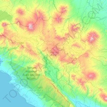
Name: Lampung Barat topographic map, elevation, terrain.
Location: Lampung Barat, Lampung, 34812, Indonesia (-5.37129 103.84359 -4.85210 104.59045)
Average elevation: 624 m
Minimum elevation: 0 m
Maximum elevation: 2,158 m
Other topographic maps
Click on a map to view its topography, its elevation and its terrain.
Tri Budisukur
Indonesia > Lampung > Lampung Barat
Tri Budisukur, Lampung Barat, Lampung, Sumatra, Indonesia
Average elevation: 908 m