
Bap Tehsil topographic map
Interactive map
Click on the map to display elevation.
About this map
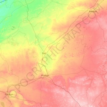
Name: Bap Tehsil topographic map, elevation, terrain.
Location: Bap Tehsil, Jodhpur, Rajasthan, India (27.11862 71.80811 27.62027 73.13401)
Average elevation: 236 m
Minimum elevation: 122 m
Maximum elevation: 364 m
Other topographic maps
Click on a map to view its topography, its elevation and its terrain.
Bhadla
India > Rajasthan > Bap Tehsil > Bhadla
Bhadla, Bap Tehsil, Jodhpur, Rajasthan, India
Average elevation: 179 m