
Mulbekh topographic map
Interactive map
Click on the map to display elevation.
About this map
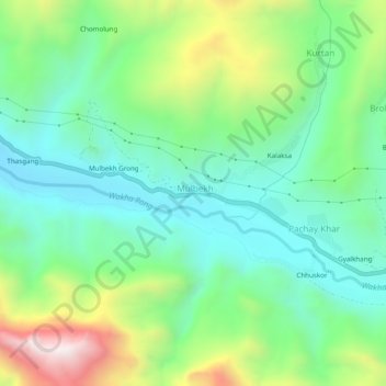
Name: Mulbekh topographic map, elevation, terrain.
Location: Mulbekh, Kargil Tehsil, Kargil District, Ladakh, India (34.35897 76.34872 34.39897 76.38872)
Average elevation: 3,511 m
Minimum elevation: 3,235 m
Maximum elevation: 4,126 m