
Lengby topographic map
Interactive map
Click on the map to display elevation.
About this map
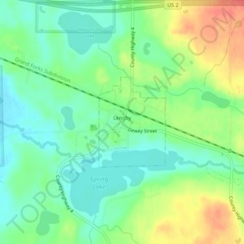
Name: Lengby topographic map, elevation, terrain.
Location: Lengby, Polk County, Minnesota, United States (47.51029 -95.63971 47.52028 -95.62873)
Average elevation: 423 m
Minimum elevation: 402 m
Maximum elevation: 458 m