
Leticia topographic map
Interactive map
Click on the map to display elevation.
About this map
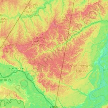
Name: Leticia topographic map, elevation, terrain.
Location: Leticia, Amazonas, 910001, Colombia (-4.23169 -70.36640 -3.00236 -69.71408)
Average elevation: 97 m
Minimum elevation: 50 m
Maximum elevation: 183 m