
Asylum topographic map
Interactive map
Click on the map to display elevation.
About this map
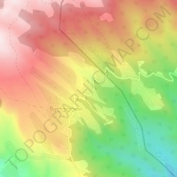
Name: Asylum topographic map, elevation, terrain.
Location: Asylum, შ 159, Didgori Raion, Tbilisi, Georgia (41.71831 44.58560 41.71841 44.58570)
Average elevation: 1,178 m
Minimum elevation: 873 m
Maximum elevation: 1,427 m
Other topographic maps
Click on a map to view its topography, its elevation and its terrain.