
Landskrona kommun topographic map
Interactive map
Click on the map to display elevation.
About this map
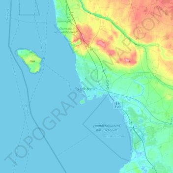
Name: Landskrona kommun topographic map, elevation, terrain.
Location: Landskrona kommun, Skåne County, Sweden (55.78037 12.65235 55.96390 13.05901)
Average elevation: 16 m
Minimum elevation: -2 m
Maximum elevation: 105 m