
Basaralu topographic map
Interactive map
Click on the map to display elevation.
About this map
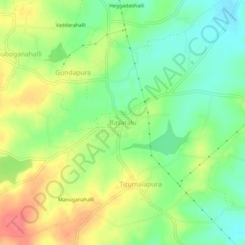
Name: Basaralu topographic map, elevation, terrain.
Average elevation: 755 m
Minimum elevation: 727 m
Maximum elevation: 789 m
Other topographic maps
Click on a map to view its topography, its elevation and its terrain.
Mandya
India > Karnataka > Mandya taluk
Mandya, Mandya taluk, Mandya district, Karnataka, 571401, India
Average elevation: 693 m