
Llanbadarn Fawr topographic map
Interactive map
Click on the map to display elevation.
About this map
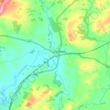
Name: Llanbadarn Fawr topographic map, elevation, terrain.
Location: Llanbadarn Fawr, Powys, Wales, United Kingdom (52.24924 -3.37306 52.29783 -3.28708)
Average elevation: 228 m
Minimum elevation: 174 m
Maximum elevation: 348 m