
Sarra topographic map
Interactive map
Click on the map to display elevation.
About this map
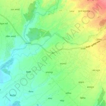
Name: Sarra topographic map, elevation, terrain.
Location: Sarra, Ghorahi, Dang, Lumbini Province, 22415, Nepal (28.01233 82.42414 28.05233 82.46414)
Average elevation: 627 m
Minimum elevation: 595 m
Maximum elevation: 675 m