
Anthisnes topographic map
Interactive map
Click on the map to display elevation.
About this map
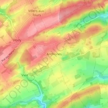
Name: Anthisnes topographic map, elevation, terrain.
Location: Anthisnes, Huy, Liège, Wallonia, 4160, Belgium (50.46166 5.50253 50.50166 5.54253)
Average elevation: 244 m
Minimum elevation: 177 m
Maximum elevation: 296 m