
Aranmula topographic map
Interactive map
Click on the map to display elevation.
About this map
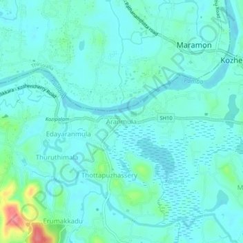
Name: Aranmula topographic map, elevation, terrain.
Average elevation: 14 m
Minimum elevation: -1 m
Maximum elevation: 79 m
Aranmula is located at 9°20′N 76°41′E / 9.33°N 76.68°E / 9.33; 76.68. It has an average elevation of 7 m (23 ft).
Other topographic maps
Click on a map to view its topography, its elevation and its terrain.
Elanthoor
India > Kerala > Kozhencherry
Elanthoor, Kozhencherry, Pathanamthitta District, Kerala, 689643, India
Average elevation: 38 m