
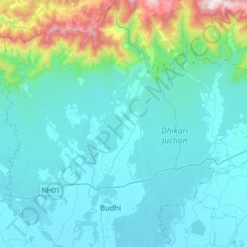
Buddhabatika topographic map
Interactive map
Click on the map to display elevation.
About this map
Name: Buddhabatika topographic map, elevation, terrain.
Average elevation: 283 m
Minimum elevation: 100 m
Maximum elevation: 1,374 m
Other topographic maps
Click on a map to view its topography, its elevation and its terrain.
Jayanagar
Nepal > Kapilvastu > Buddhabatika
Jayanagar, Buddhabatika, Buddhabhumi, Kapilvastu, Lumbini Province, 32809, Nepal
Average elevation: 113 m