
Holeri topographic map
Interactive map
Click on the map to display elevation.
About this map
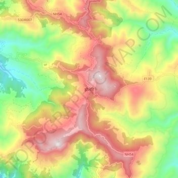
Name: Holeri topographic map, elevation, terrain.
Location: Holeri, Dubaring, Runtigadi, Rolpa, Lumbini Province, Nepal (28.14402 82.46645 28.22402 82.54645)
Average elevation: 1,588 m
Minimum elevation: 1,038 m
Maximum elevation: 2,143 m