
Southaven topographic map
Interactive map
Click on the map to display elevation.
About this map
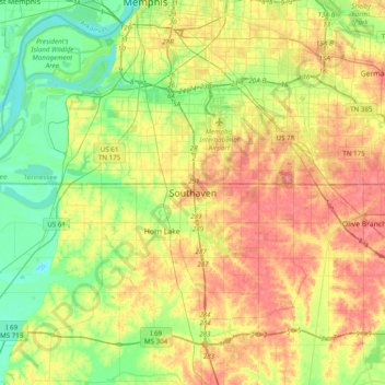
Name: Southaven topographic map, elevation, terrain.
Location: Southaven, DeSoto County, Mississippi, 38671, United States (34.82738 -90.16349 35.14738 -89.84349)
Average elevation: 89 m
Minimum elevation: 54 m
Maximum elevation: 133 m