
Crittenden topographic map
Interactive map
Click on the map to display elevation.
About this map
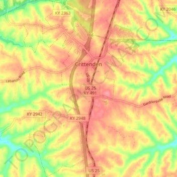
Name: Crittenden topographic map, elevation, terrain.
Location: Crittenden, Grant County, Kentucky, 41030, United States (38.74651 -84.63227 38.80340 -84.59119)
Average elevation: 262 m
Minimum elevation: 216 m
Maximum elevation: 290 m