
Hedgesville topographic map
Interactive map
Click on the map to display elevation.
About this map
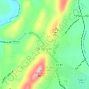
Name: Hedgesville topographic map, elevation, terrain.
Location: Hedgesville, Berkeley County, West Virginia, United States (39.55112 -77.99811 39.55833 -77.99112)
Average elevation: 184 m
Minimum elevation: 121 m
Maximum elevation: 286 m