
Thailisain topographic map
Interactive map
Click on the map to display elevation.
About this map
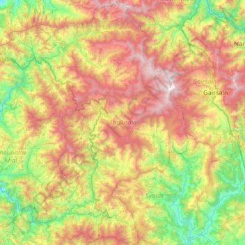
Name: Thailisain topographic map, elevation, terrain.
Location: Thailisain, Pauri Garhwal, Uttarakhand, India (29.77112 78.90707 30.22503 79.23142)
Average elevation: 1,704 m
Minimum elevation: 776 m
Maximum elevation: 3,066 m
Other topographic maps
Click on a map to view its topography, its elevation and its terrain.
Dungri Malli
India > Uttarakhand > Thailisain
Dungri Malli, Thailisain, Pauri Garhwal District, Uttarakhand, India
Average elevation: 2,040 m
Bhakhand
India > Uttarakhand > Thailisain
Bhakhand, Thailisain, Pauri Garhwal, Uttarakhand, 246177, India
Average elevation: 1,523 m
Chopta
India > Uttarakhand > Thailisain
Chopta, Thailisain, Pauri Garhwal District, Uttarakhand, 246275, India
Average elevation: 1,921 m