
Alpu topographic map
Interactive map
Click on the map to display elevation.
About this map
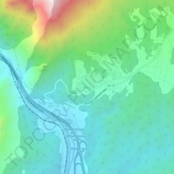
Name: Alpu topographic map, elevation, terrain.
Location: Alpu, Pozantı, Adana, Mediterranean Region, Turkey (37.45096 34.86196 37.49096 34.90196)
Average elevation: 1,072 m
Minimum elevation: 796 m
Maximum elevation: 1,964 m
Alpu, also Alpıköy, is a town and district of Eskişehir Province in the Central Anatolia region of Turkey. According to 2010 census, population of the district is 12,768 of which 5,126 live in the town of Alpu. The district covers an area of 886 km2 (342 sq mi), and the town lies at an average elevation of 768 m (2,520 ft).