
Singrauli topographic map
Interactive map
Click on the map to display elevation.
About this map
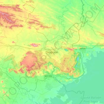
Name: Singrauli topographic map, elevation, terrain.
Average elevation: 348 m
Minimum elevation: 226 m
Maximum elevation: 633 m
Other topographic maps
Click on a map to view its topography, its elevation and its terrain.
riber
India > Madhya Pradesh > Singrauli Tahsil
riber, Nando, Singrauli Tahsil, Singrauli District, Madhya Pradesh, India
Average elevation: 388 m