
Narsinghpur topographic map
Interactive map
Click on the map to display elevation.
About this map
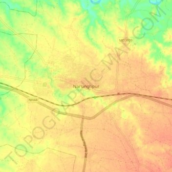
Name: Narsinghpur topographic map, elevation, terrain.
Average elevation: 356 m
Minimum elevation: 327 m
Maximum elevation: 369 m
Narsinghpur is located at 22°57′N 79°12′E / 22.95°N 79.2°E / 22.95; 79.2. It has an average elevation of 347 metres (1,138 ft).
Other topographic maps
Click on a map to view its topography, its elevation and its terrain.
Nayakhera
India > Madhya Pradesh > Narsimhapur Tahsil
Nayakhera, Narsimhapur Tahsil, Narsinghpur District, Madhya Pradesh, India
Average elevation: 347 m